简报
(第七期)
RESIL FARM 项目组
2026年9月6日
RESIL FARM 项目交流会在华盛顿特区顺利召开
国际食物政策研究所游良志研究员、郭喆研究员现场参加研讨
2026年8月9-13日,RESIL FARM 项目骨干,中国科学院地理科学与资源研究所史文娇研究员在美国华盛顿特区与国际食物政策研究所(International Food Policy Research Institute,IFPRI)游良志研究员、郭喆老师开展学术交流。双方围绕国家重点研发计划国际战略科技合作项目 RESIL FARM 的实施进展、高标准农田产能与韧性提升效果评价、复杂农业系统时空分析与优化,以及 IFPRI 在农业、食物系统和气候韧性领域的研究项目进行了深入讨论。
本次研讨以本项目研究中高标准农田建设对粮食产能、固碳效应和气候韧性的协同提升机制为主线,重点围绕建设效果的科学识别、不同尺度数据与模型的衔接,以及研究成果向农业和食物系统政策分析的拓展展开。双方结合中国高标准农田建设实践和 IFPRI 在空间数据、分析建模及食物政策研究方面的经验,就如何构建从田块监测、区域评价到宏观政策模拟的完整研究链条进行了交流。
史文娇研究员介绍了 RESIL FARM 项目的总体进展及中国科学院地理科学与资源研究所承担的研究任务。团队依托中国高标准农田建设实践、遥感和田间调查数据,重点开展高标准农田产能提升效果评价、空间分异识别及影响机制分析,探索稳产、固碳和抗灾能力协同提升的区域路径。具体地,在东北地区玉米主产区的研究中,团队通过匹配分析和双重差分方法识别高标准农田建设的净效应,并从产量增长、抗灾能力和空间均一性等方面开展综合评价。史文娇研究员还介绍了团队在复杂农业系统时空信息智能分析、农业生产过程模拟和空间优化方面的相关成果。围绕“变量格局刻画—过程演变模拟—格局优化调控”的研究思路,团队构建了农业资源要素高分辨率制图、气候和灌溉影响定量归因、资源环境阈值模拟以及粮食—水—氮—碳多目标优化等方法。在高标准农田综合效益评价方面,团队综合经济、社会和生态指标开展空间预测,识别不同地貌、资源条件和建设模式下的效益差异,相关成果已为高标准农田建设规划、农业遥感监测和区域农业布局优化提供支撑。
游良志研究员和郭喆研究员介绍了 IFPRI 在农业与食物系统研究方面的主要项目、数据基础和政策分析工具。游良志研究员重点介绍了气候韧性、农业生态系统、空间数据分析和农业科技政策等研究,以及空间生产分配模型(SPAM)、农业技术评价模型(DREAM)等工具在全球农业生产格局分析和技术投资评价中的应用。郭喆研究员介绍了地理信息系统、遥感数据整合和空间可视化在农业生产、气候风险及食物系统研究中的作用。两位研究员还分享了 IFPRI 通过多尺度空间数据、模型模拟与实证调查相结合,分析农业生产、市场、营养、资源环境和社会包容问题的研究思路,分享研究所发布的《变化世界中的食物政策研究:IFPRI 2026—2030 战略》等国际公开报告。围绕包容性增长与转型、韧性和可持续食物生产、公平高效的市场与贸易、可持续健康膳食与营养、经济和社会包容五个主题,提出通过前景研判、方案检验与推广、制度环境塑造以及工具方法和能力建设,推动食物政策研究成果的应用与转化。
围绕双方正在开展的工作,研讨重点讨论了如何将中国田块尺度高分辨率研究数据与 SPAM 等国际农业空间数据及作物、经济模型相衔接,开展跨区域、跨尺度的比较研究;在产能和抗灾评价基础上,进一步纳入水氮利用、碳排放、农户收益和风险保障等指标,将高标准农田研究拓展至气候韧性食物系统的综合评价。
本次交流研讨表明,中国高标准农田建设效果评价与 IFPRI 的空间数据、分析建模和食物系统政策研究具有较好的衔接基础。后续可围绕典型区域农田基础设施建设效果与气候适应能力开展联合研究,加强高分辨率遥感数据、田间调查数据和国际农业空间数据的共享与集成;探索将工程建设措施转化为作物和经济模型中的情景参数,综合评估其对粮食产能、资源利用、碳效应和农户生计的影响;并通过联合论文、开放数据产品和中英文政策简报等形式,为农业基础设施投资优化及气候韧性食物系统建设提供科学支撑。
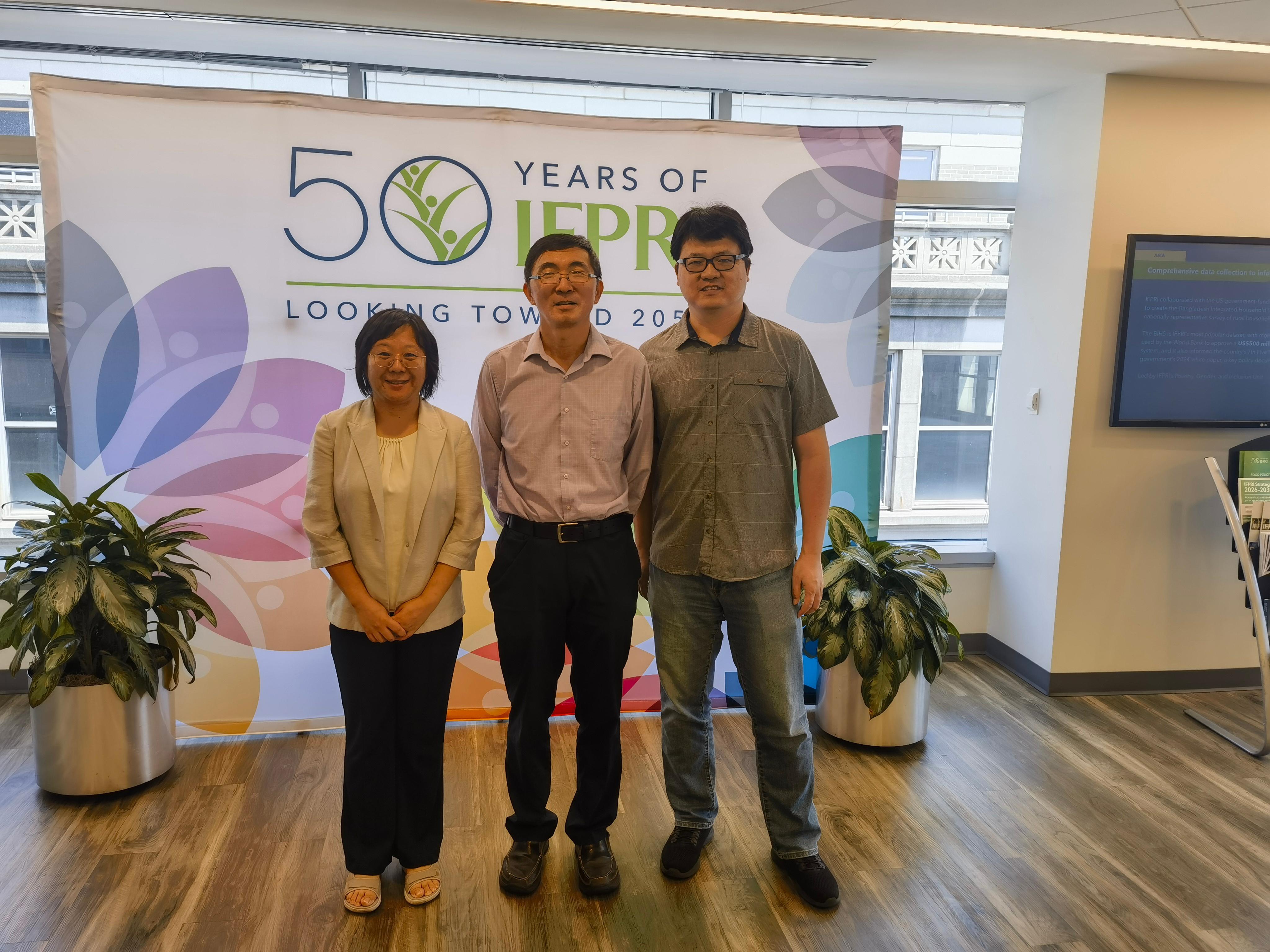
图:史文娇研究员与 IFPRI 研究人员在华盛顿特区交流合影
Briefing (Issue No. 7)
RESIL FARM Project Workshop Successfully Held in Washington, DC
From August 9 to 13, 2026, Wenjiao Shi, the core member of the RESIL FARM project and a research professor at the Institute of Geographic Sciences and Natural Resources Research, Chinese Academy of Sciences (IGSNRR, CAS), held an academic exchange in Washington, DC, with Liangzhi You and Zhe Guo of the International Food Policy Research Institute (IFPRI). The discussion focused on the implementation progress of RESIL FARM, an international strategic science and technology cooperation project under China's National Key R&D Program; evaluation of improvements in the productivity and resilience of well-facilitated farmland; spatiotemporal analysis and optimization of complex agricultural systems; and IFPRI's research programs on agriculture, food systems, and climate resilience.
The workshop centered on the mechanisms through which well-facilitated farmland construction may jointly improve food-production capacity, carbon outcomes, and climate resilience. Discussion focused on rigorous identification of construction effects, integration of data and models across spatial scales, and extension of project findings into agricultural and food-system policy analysis. Drawing on China’s experience with well-facilitated farmland and IFPRI’s expertise in spatial data, foresight modeling, and food-policy research, the two sides examined how field monitoring, regional evaluation, and macro-level policy simulation could be connected within a coherent research framework.
Professor Shi presented the overall progress of RESIL FARM and the research tasks undertaken by IGSNRR, CAS. Using evidence from China's well-facilitated farmland program, remote sensing, and field surveys, the team is evaluating improvements in farmland productivity, identifying spatial differences in construction outcomes, and examining the factors that shape those outcomes. The work aims to identify regional pathways that can improve yield stability, carbon performance, and resistance to climate-related shocks. In maize-producing areas of Northeast China, the team used matching methods and difference-in-differences analysis to estimate the net effects of farmland construction and evaluated changes in yield growth, disaster resistance, and spatial homogeneity. Professor Shi also presented related work on intelligent spatiotemporal analysis, agricultural-process simulation, and spatial optimization of complex agricultural systems. Following a research sequence from mapping variable patterns, to simulating process change, and then optimizing spatial configurations, the team has developed methods for high-resolution mapping of agricultural resources, quantitative attribution of climate and irrigation effects, simulation under resource and environmental thresholds, and multi-objective optimization across food, water, nitrogen, and carbon. The team has also integrated economic, social, and ecological indicators to predict the spatial distribution of benefits from well-facilitated farmland and to identify how outcomes vary across landforms, resource conditions, and construction models. These results have supported farmland planning, agricultural remote-sensing monitoring, and regional optimization of agricultural production.
Liangzhi You and Zhe Guo presented IFPRI's major research programs, data resources, and policy-analysis tools related to agriculture and food systems. You introduced research on climate resilience, agroecosystems, spatial-data analysis, and agricultural science and technology policy, as well as the application of the Spatial Production Allocation Model (SPAM) and the DREAM agricultural technology assessment model to global agricultural production patterns and technology investment. Guo discussed the role of geographic information systems, remote-sensing data integration, and spatial visualization in the analysis of agricultural production, climate risk, and food systems. They also explained IFPRI's approach to combining multi-scale spatial data, model-based analysis, and empirical surveys to examine connections among agricultural production, markets, nutrition, natural resources, and social inclusion, and shared several publicly available reports issued by the institute, including Food Policy Research for a Changing World: IFPRI Strategy 2026-2030. Organized around five themes - inclusive growth and transformation; resilient and sustainable food production; fair and efficient markets and trade; sustainable healthy diets and nutrition; and economic and social inclusion - the strategy proposes advancing the application and translation of food-policy research through foresight and outlook analysis, testing and scaling solutions, shaping enabling environments, and strengthening tools, methods, and capacity.
Drawing on the ongoing work of both sides, the workshop focused on how China's high-resolution plot-level research data can be linked with international agricultural spatial datasets such as SPAM and with crop and economic models to support cross-regional and cross-scale comparative research. The discussion also considered how assessments can move beyond production capacity and disaster resistance to include water and nitrogen use, carbon emissions, farm household income, and risk-protection indicators, thereby extending research on well-facilitated farmland to a comprehensive evaluation of resilient food systems.
The exchange identified a strong basis for linking China’s evaluation of well-facilitated farmland with IFPRI’s spatial datasets, foresight models, and food-system policy research. Future collaboration could compare the performance and climate-adaptation capacity of farmland infrastructure in representative regions, while strengthening the integration of high-resolution remote-sensing data, field surveys, and international agricultural spatial datasets. The two sides could also explore how engineering measures can be translated into scenario parameters for crop and economic models, allowing their effects on food-production capacity, resource use, carbon outcomes, and farm livelihoods to be assessed jointly. Joint papers, open-data products, and bilingual policy briefs could then translate the research into evidence for agricultural infrastructure investment and the development of climate-resilient food systems.